
Ahora rentando apartamentos de 2 habitaciones • Excelente ubicación • Vida asequible
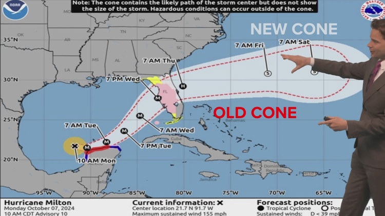
The new version of the forecast cone provides a more complete picture of possible storm tracks based on forecast errors from the past five years.
NEW ORLEANS — The National Hurricane Center is introducing a new experimental version of the hurricane forecast cone in 2026, and the biggest change is its shape.
Instead of circles, the cone will use ellipses anchored at each forecast point. This allows forecasters to better show two types of error, whether a storm is faster or slower than expected and whether it shifts left or right of the forecast path. The result is a more realistic depiction of how storms behave.
The new cone will also expand the uncertainty it represents. The current cone is based on a range that captures about 67% of past forecast outcomes. The new experimental version increases that to 90%, meaning the center of the storm is expected to stay within the cone nine out of ten times. While this may make the cone appear wider, it provides a more complete picture of possible storm tracks based on forecast errors from the past five years.
According to the NHC, this updated cone is designed to improve how people understand risk. By better representing uncertainty in both speed and direction, it reinforces that a storm’s impacts are not limited to a single line or even strictly inside the cone.
The graphic will be released as an experimental product during the 2026 season, allowing forecasters to evaluate its performance and gather public feedback before making it permanent.
💌 Mantente al Día con lo Último del Entretenimiento Latino
Recibe noticias exclusivas de celebridades latinas, chismes virales, belleza, moda y entretenimiento — directo en tu correo.
Sin spam. Solo lo mejor de Atlanta Latinos Magazine.