


Ahora rentando apartamentos de 2 habitaciones • Excelente ubicación • Vida asequible
NOAA will begin using Meteodrones to observe long parts of the lower atmosphere, improving insight into weather forecasting.
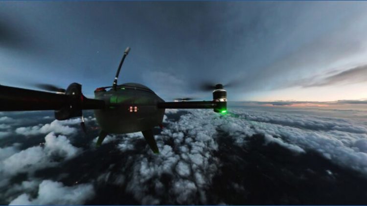
SAN ANTONIO — The National Oceanic and Atmospheric Administration (NOAA) is breaking new ground in the atmosphere and in operational weather forecasting by integrating data from autonomous weather drones in the U.S. weather observation network.
These drones, called Meteodrones, are scheduled to fly routine missions through April 2026 from a remotely operated base in Oklahoma, helping to fill a persistent gap in atmospheric data between roughly 50 feet and 20,000 feet above the ground. Despite operational forecasting, this is one of the least explored layers of the atmosphere.
Meteodrones are equipped to gather detailed vertical profiles of the atmosphere — key meteorological variables such as temperature, humidity and winds.
This altitude range is critical for understanding the development and progression of thunderstorms, fog, low-level wind events, and pressure changes.
In addition, exploring air pollution meteorology such as the dispersion of smoke and poor air quality.
By delivering high-frequency, the drones aim to give forecasters more reliable and timely data, helping improve forecast confidence and enhance public safety.
The pilot represents a significant step in expanding NOAA’s observational capabilities through public-private collaboration, leveraging Meteomatics’ drone technology along with data integration support from partners KBR and Synoptic Data PBC.
The Meteodrone data will be woven into existing forecast models and operations, potentially leading to more accurate forecasts and earlier warnings for weather hazards that affect aviation, transportation, emergency management and everyday life.
💌 Mantente al Día con lo Último del Entretenimiento Latino
Recibe noticias exclusivas de celebridades latinas, chismes virales, belleza, moda y entretenimiento — directo en tu correo.
Sin spam. Solo lo mejor de Atlanta Latinos Magazine.


