


Ahora rentando apartamentos de 2 habitaciones • Excelente ubicación • Vida asequible
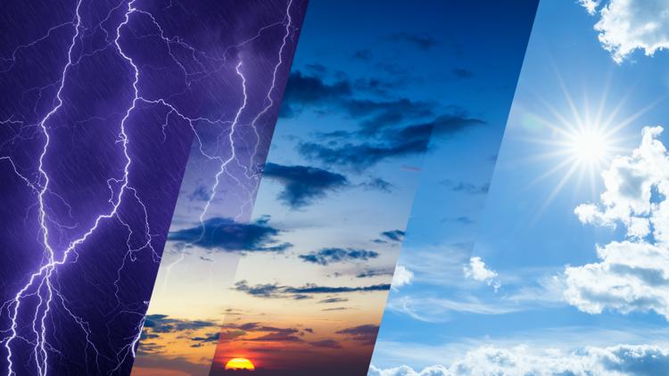
Weather forecasting is one of the most advanced sciences on Earth. But it’s also one of the most complex and humbling.
CLEVELAND — OK. I have a confession to make. Sometimes meteorologists miss the forecast.
Every day, meteorologists around the world work non-stop to predict what the sky will do next. We have the best technology that money can buy. We use satellites, radar, and weather balloons. We have supercomputers that crunch trillions of calculations every day. Yet even with all that technology, your daily local forecast can still change.
Or miss the mark altogether.
The truth? Weather forecasting is one of the most advanced sciences on Earth. But it’s also one of the most complex and humbling.
The atmosphere is an ocean of constantly moving air. It’s a mix of swirling chaos, randomness, and hidden surprises. Predicting it perfectly is like trying to count every wave in the ocean. It’s just not possible.
Modern forecasts are powered by computer models. These are massive simulations that use physics, math, and real-time data to predict how the atmosphere will behave in the coming hours, days, or weeks ahead. Every six to twelve hours, global weather models are updated using information gathered from thousands of sources. These sources include:
Weather balloons launched twice daily from select locations around the world.
Satellite observations that scan cloud cover, sea surface temperatures, and water vapor.
Radar systems tracking precipitation and storm movement.
Aircraft sensors measuring temperature and wind during flights.
This data is fed into supercomputers that use fancy equations representing the laws of motion, thermodynamics, and fluid dynamics. Lots of technical stuff in there for sure. The result, hopefully, is an accurate picture of how air and weather systems will move across the planet in the near future.
But, there’s a catch. These computer guidance models are only as good as the data we feed into them.
Meteorologists often say, “We don’t know what we don’t measure.” Despite all the satellites orbiting Earth and thousands of ground-based sensors, we only observe a tiny fraction of the atmosphere in real time. Think of the atmosphere as a giant three-dimensional puzzle stretching from the ground to the edge of space. To predict what that ocean of air is going to do with 100% accuracy, we’d need complete, high-resolution data for every point in that puzzle. We need to measure every molecule of air, every gust of wind, every change in humidity. But that’s impossible.
Imagine slicing Earth’s atmosphere into millions of tiny cubes. Each one represents a piece of air with its own temperature, humidity, and wind. Computer models take all those cubes and calculate how they’ll move, mix, and change over time.
Step 1 – Collect the data: It’s a snapshot of Earth’s atmosphere right now. Satellites, weather balloons, radars, and aircraft feed real-world data into the guidance model.
Step 2 – Do the math: Supercomputers then solve thousands of mathematical equations for each cube of air, predicting how it will evolve in the next few minutes, hours, and days.
Step 3 – Produce the forecast: The models spit out possible forecast scenarios. They attempt to predict storm tracks, intensity, temperature maps, and rainfall totals. Meteorologists compare several models to see where they agree and where they don’t.
Step 4 – Add the human touch: Finally, forecasters use their own knowledge and experience to adjust those model outputs blending science with intuition.
The result is a forecast that’s more accurate than ever… but still can’t be perfect. That’s because even the tiniest unknowns, a missing data point or a change in ocean temperature, can affect and change the entire system.
Right now, we collect perhaps one data point for every trillion cubic feet of air. That’s like trying to predict ocean currents by measuring the temperature in just a few buckets of water.
One of the biggest gaps in global weather data lies over the world’s oceans. They cover more than 70% of the planet. Satellites can “see” large-scale patterns over the oceans. They see storm systems and sea surface temperatures. But they can’t measure everything meteorologists need in those areas. We don’t have anything to measure exact wind speed or temperature at multiple levels in the atmosphere over the oceans.
To fill these gaps, scientists rely on a handful of buoys, ships, and aircraft. But even with those resources, coverage and measurements remain sparse. The result is fewer observations, less accurate model initialization, and larger forecast errors. Those errors are especially obvious for hurricanes and tropical storms that develop far from land.
That’s why storms can change track or intensity more than expected. Without lots of detailed data, the computer models have to “guess” what’s happening over the open ocean.
Even if we could measure every molecule of air, forecasts would still never be perfect. Why? Because the atmosphere is a chaotic system. The atmosphere is so sensitive that the tiniest differences in initial conditions can lead to vastly different outcomes.
This concept is known as the Butterfly Effect. It suggests that a butterfly flapping its wings in Brazil could theoretically change wind speed and direction enough to influence the path of a tornado weeks later in Texas.
In weather terms, that means if one measurement is off by just a fraction, like a slightly different temperature or wind speed, it can throw off the entire chain of calculations days later. That’s why forecasts are most reliable within 2 to 3 days. Beyond a week, uncertainty and forecast errors grow exponentially.
Even though perfection is impossible, today’s forecasts are more accurate than ever before. A 5-day forecast today is as reliable as a 3-day forecast was just 20 years ago. That progress saves lives, guides farmers, fuels shipping routes, and helps communities prepare for severe weather. And now with private sector weather satellites, artificial intelligence, crowd-sourced home weather stations, and smartphone sensors, forecasts should become even more accurate. Each new data point helps us chip away at the uncertainty.
Weather forecasting isn’t broken. It’s simply limited by physics, chaos, and the sheer size and scope of the earth’s atmosphere. Until we can measure every cubic inch of air in real time (and we can’t), there will always be uncertainty. Don’t look at forecasts as wrong. They’re human, dynamic, and constantly improving.
So, the next time your weather app shifts from “sunny” to “stormy,” remember this: predicting the planet’s atmosphere isn’t about perfection. It’s about progress.
Mark Johnson is a meteorologist from WKYC in Cleveland. Check your local forecast from your trusted weather team here.
💌 Mantente al Día con lo Último del Entretenimiento Latino
Recibe noticias exclusivas de celebridades latinas, chismes virales, belleza, moda y entretenimiento — directo en tu correo.
Sin spam. Solo lo mejor de Atlanta Latinos Magazine.


